

Carefully planned, executed to the millimetre.
We plan machines, plants and process flows that fit your requirements, your space and your goals, and on request accompany you all the way to the turnkey plant.
From the idea to the turnkey plant.
Efficient plant operation begins with careful planning. We develop individual concepts for machines, plants and process flows, tailored to your requirements, spatial conditions and goals. Whether new build, conversion or extension: well thought out, made to measure, future-proof.
- 01
Engineering and technical design
We analyse your requirements, production targets and operating conditions and develop several technical options in comparison, from the degree of automation to the machine type, evaluated by cost, space requirements, expandability and energy efficiency. Added to this are process planning with optimised material and work flows, sequence and cycle-time planning, and interfaces to IT, control and ERP systems. On request we prepare technical specifications and tender documents including a supplier comparison.
- 02
3D design of complete plants
We create true-to-scale 2D and 3D layout drawings for machines, conveying technology, operating routes and safety areas and integrate them into your existing building structures, including storage and retrieval logistics. Legal requirements such as occupational safety, escape routes and CE marking are considered from the start. All planning documents, drawings and technical data are handed over to you, and on request we support you with CE-compliant documentation.
- 03
3D scanning of existing plants
With a 3D scan we digitally capture your existing plant, the reliable basis for conversions, extensions and the integration of new machines. We record plant layouts, media connections and material flows and create detailed 3D models of your mill system.
- 04
Custom machines for existing plants
We plan plant conversions, modernisations and capacity extensions and integrate individual new machines into existing production lines. We adapt machine configurations to existing plants and control systems, including retrofitting sensors, controls and automation technology. We also realise special designs and adaptations to your particular requirements.
- 05
Turnkey projects
Complete project delivery from one source: we coordinate suppliers, technicians and trades, supervise the implementation on site and keep costs, deadlines and quality in view throughout the realisation phase. Even after acceptance we continue to support you with optimisations and extensions, with one dedicated contact from the idea to acceptance.
No more outdated drawings.
For conversions and extensions to existing plants, up-to-date drawings are often missing or no longer match reality. With a 3D laser scan we capture the as-is state of your plant precisely and completely. That lets you plan on a solid data basis, avoid costly measurement errors and collisions, and save time on site.
-
Reliable data basis
A millimetre-accurate image of your plant instead of incomplete old drawings, available at any time.
-
Plan collision-free
New machines and pipes fit first time, verified against the real plant, not on paper.
-
Less site risk
A single scan appointment replaces repeated re-measuring and reduces downtime.
-
Well-founded decisions
Dimensions, clearances and connection points are known in advance, quotes become more precise.
From point cloud to model.
The scan delivers millions of precisely measured points. Pick an example.
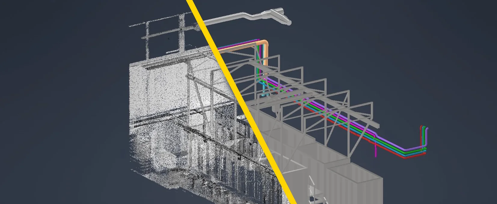
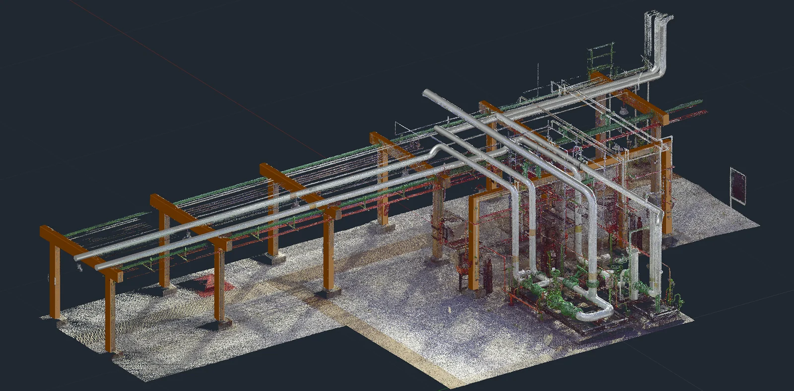
Pipe bridge: from the scanned point cloud to the constructed CAD model.
To a digital twin in four steps.
From the on-site appointment to the finished model, a clearly structured process we handle entirely from one source.
- 01
On-site scan
With the FARO Focus we scan your plant from several positions, contactless, during operation and in a short time.
- 02
Registration
The individual scans are merged into a single, positionally accurate overall point cloud and checked.
- 03
3D model
From the point cloud we construct a dimensionally accurate CAD model, steelwork, piping and machines as clean geometry.
- 04
Integration into planning
The model becomes the basis of your new planning, we fit new components into the existing plant, collision-checked.
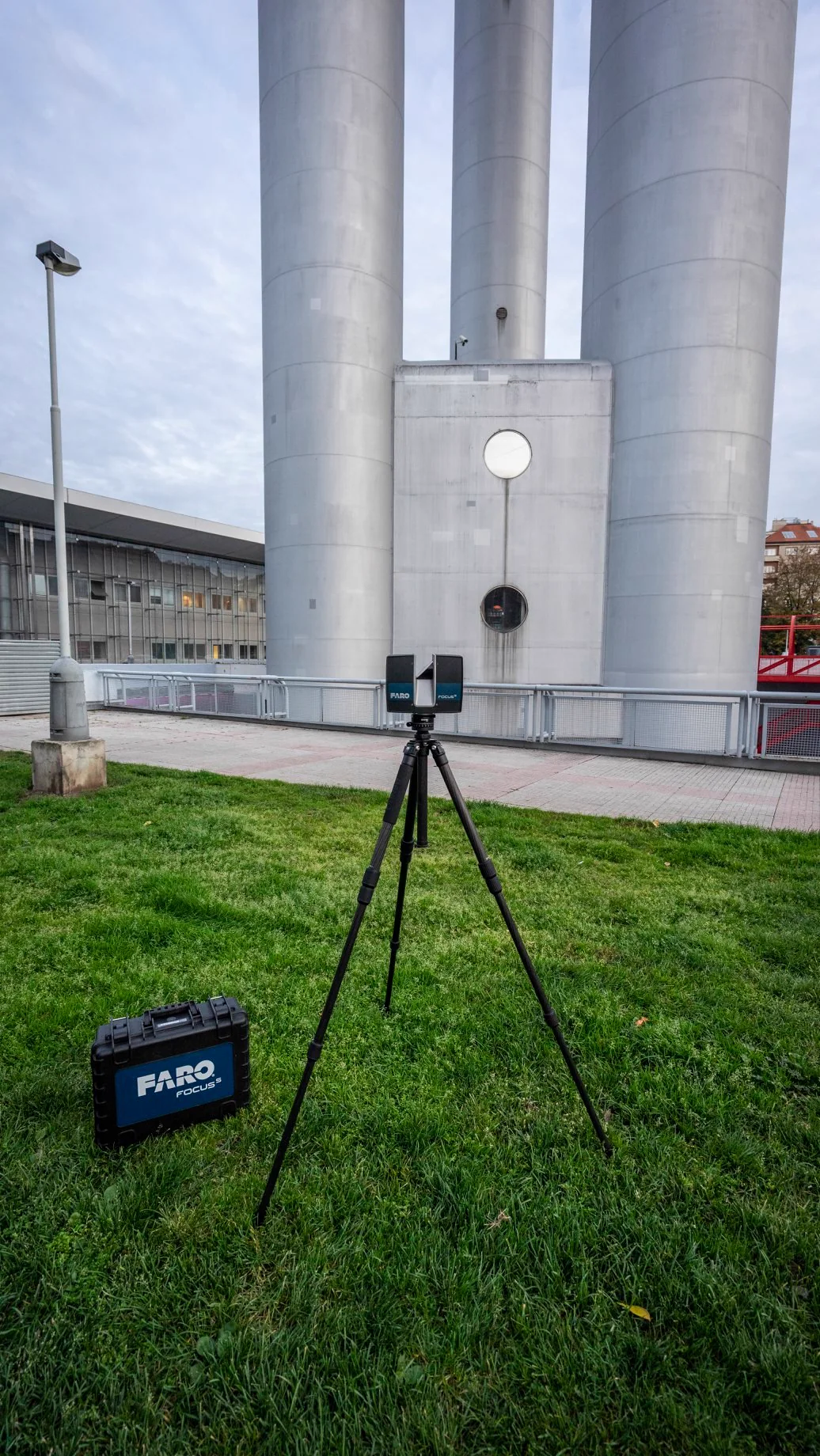
FARO Focus, measurement at reference level.
The FARO Focus captures its surroundings with a rotating laser beam and delivers up to hundreds of thousands of measurement points per second, millimetre-accurate and in colour. The result is a complete, true-to-scale image of your plant that we transfer into common CAD and planning formats.
- mm
- Accuracy in the millimetre range
- 360°
- All-round capture per position
- Colour
- Point cloud with real colour values
- CAD
- Export to common planning formats
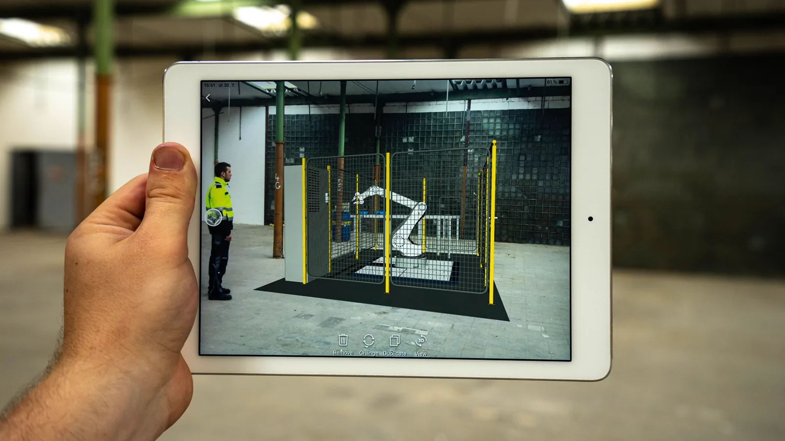
Make planning tangible.
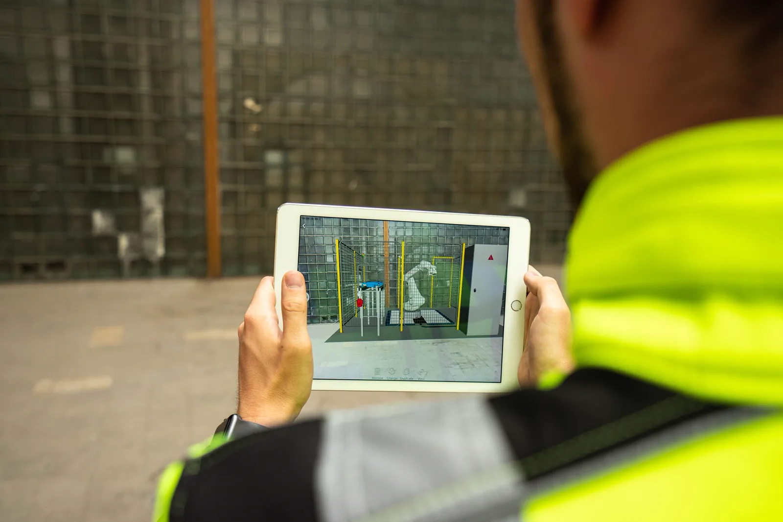
On request we make planned plant parts visible on site via augmented reality, so you see new machines in their real environment before the first bolt is fitted.
Point clouds that speak for themselves.
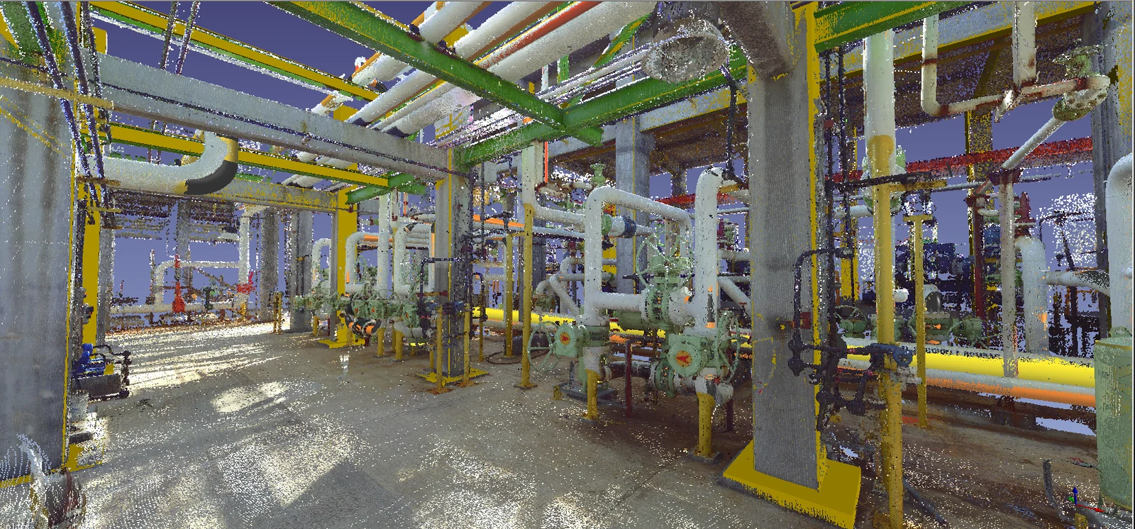
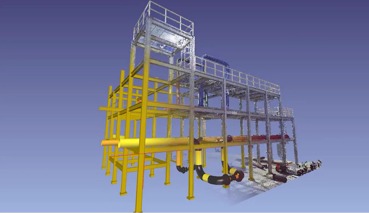
A selection of real scan results, from the coloured overall capture to the extracted piping model.
Where the scan pays off.
Wherever planning, conversion or extension happens and exact dimensions and well-thought-out concepts decide between success and costly rework.
- Mills & grain stores
- Feed mills
- Bulk-material & process plants
- Conveying technology & silo construction
- Conversion & extension of existing plants
- Modernisation & retrofit
Good to know.
What is a 3D laser scan?
A laser scanner captures the surroundings contactless and records millions of precisely measured points. This "point cloud" is a true-to-scale digital image of your plant.
Does the plant have to be shut down for the scan?
Usually not. We scan contactless and in many cases can work during operation, keeping downtime to a minimum.
How accurate is the result?
The FARO Focus works in the millimetre range. For surveying, collision checking and plant planning that is more than accurate enough.
In which formats do I receive the data?
You receive the point cloud and, on request, a 3D model constructed from it in common CAD and planning formats that can be processed directly.
Is it worth it even for smaller conversions?
Yes. Even for a single new unit, an exact survey prevents costly measurement errors and saves repeated re-measuring on site.
Do you also handle the complete project?
Yes. For turnkey projects we coordinate suppliers, technicians and trades, supervise costs, deadlines and quality on site and hand over the finished plant to you, with one dedicated contact from the idea to acceptance.
Which documents do I receive from the planning?
True-to-scale 2D and 3D layout drawings, on request technical specifications and tender documents for the supplier comparison, plus support with CE-compliant documentation. All documents are handed over to you in full.
Plan your plant, request now.
Tell us about your project. We check which approach is right, from the 3D scan to the turnkey project, and make you a suitable offer.